Michigan Upper Peninsula: Day #3

Our last day in the Upper Peninsula started out with breakfast and checking out of our motel.  We had a big day planned.

First, we visited Presque Isle Park which is located on the northern edge of Marquette, MI, just north of Northern Michigan University (“presque-isle” is from the French meaning almost an island).  This is a lovely park right on Lake Superior.  There’s a 1,216 foot breakwater with a lighthouse at the end.

7094942C-623E-4787-BA3E-BA4C2961FA52489AD1A1-6009-402C-9EE2-FE297F769CCDF12C719C-D39B-42CE-9E57-03770621226B

There is also an iron ore dock exactly like the one in downtown Marquette that is no longer in use. This dock was completed in 1912 by the Lake Superior and Ishpeming Railway and is still in use today.

B246C70C-78F5-4C54-86E4-AD91EDE9A7A9

The dock is built of steel-reinforced concrete and is 1,250 feet long.  It is 75 feet tall above the water, 60 feet wide, and has 200 ore pockets with a storage capacity of 50,000 tons.  After the ore is mined, it is crushed and put through a process that results in it being rolled into small balls and fired in a kiln.

These balls are known as taconite pellets which are shipped by rail to this dock next to Presque Isle Park where rail cars dump them into bins within the dock.  Once a freighter is ready to be loaded, chutes from the ore dock bins are lowered into the cargo hatches, and a door at the bottom of the bin is raised. This permits the pellets to roll into the ship.  This would have been interesting to watch, but, unfortunately, we weren’t lucky enough to be there on a day that a ship was being loaded.

Next we followed a road through the park and stopped several times to enjoy the view.

0423E565-2606-462F-ABD8-6AEE94B6F239DBAE3C2C-6575-4994-AAC7-52E0A60242E254FD7581-C8FA-47E2-A0B6-9F438BB5A85A3E592734-D0EA-4257-A3C9-FE9C6EADF2FC4AD1415A-317D-4F49-AEA5-F5C30FFEE81B0FC889D1-F827-4EC9-B280-847A7E0E1392

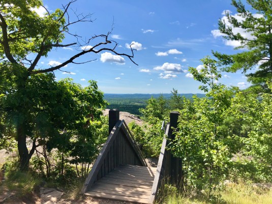
Then we headed a few miles north of Marquette to Sugarloaf Mountain.  My teacher friend who grew up in this area, recommended hiking to the top of Sugarloaf Mountain to enjoy the stunning views.  It took us about 30-40 minutes to hike to the 1,060 ft. summit.  There were 311 stair steps to get to the top (on the “easy” path, of course!), but it was worth it.  Look at these spectacular views!

2F295F7D-BD9B-40E8-A033-696D9257B0A7

At the beginning of the hike, and all eager to go.

5273B350-2EC2-4058-949D-7CB5F164ECBD

The trail gets steeper.

908284B3-40DA-458B-B685-2A6DA0261C10

First view of Lake Superior.

92ABA8AC-DF19-4511-81D1-4BC25BAD335F

GORGEOUS views all around us!

4B0C993D-C2FC-41BE-BA87-98D976B13F8A

Top of the final set of stairs!

263F5EB2-6DAC-48AA-92A9-CF595B5A4A835C1D7D91-4C42-41F0-826F-72D4F47C64DCFBA26712-0312-4BC9-975E-1420C556AB58

37A2ACB2-538C-42CB-9618-7F7132C141E0

In the distance is Presque Isle Park. You can see the two smoke stacks that are close to the iron ore loading dock.

BEAA8BB8-0C2D-41AF-8C13-2E500F0B4B5F

The lake is such a BEAUTIFUL color blue! Can you see that tiny island out there?

E748FEA3-4C17-4B92-90B1-D42FDA5C4F52F58B9764-20A1-4E14-B181-A8C3F5997149640411A3-710D-4AD4-8B12-486CC5A38C07

D967BDF9-D472-4713-BE3A-56A507903EBE

These two guys did NOT take the “easy” path that we took. I’m pretty sure they took the “more difficult” path. In this picture is one of the three platforms at the summit.

98CBEE77-196F-4D77-B5EE-728CA310198B

The main overlook platform.

6671B0A4-7283-4C75-AE31-05985E0BC077

I’m not sure Zoey enjoyed the beauty as much as we did.

C1B5B42B-B20D-489F-998F-82B9885A4668

I zoomed in so you could really see the smoke stacks.

539D57F5-98BD-45ED-B56A-296CA8E10D0D

Another one of the three platforms.

451FAEAF-4DA1-44BA-8FDF-C4C464B37328

Ready to hike back DOWN the mountain. This should be easier.

AB66C520-9C18-4BE9-BFB3-737CF7FF09EA

Walking in the forest here is just GORGEOUS!

0CC6E71A-0D48-465A-86D0-54FDF6FCA2FA

“Hurry up, Mom! We are almost to the car and I’m tired, hot, and thirsty.” Which one of these two do you think said that? 😆😂

After Sugarloaf Mountain, we returned to Marquette for some lunch.  We had planned to drive up to Copper Harbor.  After putting Copper Harbor in my GPS and seeing how long it would take to drive there, we decided it was too late in the day to do that much driving.  It would put us back at the RV too late at night, so we headed home.

All in all, we had a wonderful time in the Upper Peninsula and can’t wait to go back some day.

So, for now ….. “On the Road Again!”

Betty

Minocqua and Potato River Falls, Wisconsin

The towns of Woodruff and Minocqua are side-by-side.  When you leave the city limits of Woodruff, you are in Minocqua.  Woodruff has a population of a little over 1,900, however, Minocqua’s population is about 4,400.  They are both clean, lovely northwoods towns right on Minocqua Lake.

During the summers these towns are busy places with tourists hiking, biking, snowmobiling (in the winter only, of course! 😊) boating, fishing, farmers’ markets, craft fairs and all kinds of places for shopping.

Minocqua, which is on an island in Minocqua Lake, started out as a logging town in the 1880s and the construction of the railroads was critical to its early growth.  Later, the railroads brought sportsmen and tourists to the area transforming it into the vacation getaway it is today.

Much of Minocqua’s business district was destroyed by a major fire in 1912, so many of the buildings on the main street today were built after that.  The business district today has a higher percentage of visitor-oriented retail stores, however, it still retains a U.S. post office, banks, restaurants, and the classic barbershop (with the red and white striped pole out front!).  Here are a few pictures of the downtown business district.

C54DDEE1-E716-4830-9237-89917404D5DD4E1EB1D6-8CF3-4324-AA48-8D918E91D1F90B1575CD-A3CF-4274-8195-A589782146E1525AFF16-785C-473F-9CE7-E977BD57F4DAAC9A1EAF-09BE-48D3-B339-D121A435CF30671E9868-EEDD-4E0C-A9F8-49087B9144410D9776D9-65A1-4840-BC54-8A6FEAD3E60E

On another day, we took a day trip to a VERY small town, Gurney, WI (if you blink, you miss the town), because just outside of Gurney is the Potato River Falls.  These falls are literally in the middle of nowhere.  As we were following our GPS, one of the last turns we made was in the middle of a field and down a gravel road.  Then, out of nowhere, there is a small turn into a parking area with a sign that said “Potato Falls.”  There are two hiking paths you can take.  One says “Upper Falls” and the other says “Lower Falls.”  We chose the Upper Falls first. The trail was clearly marked, and they were wooden stairs at the steepest points (thank goodness!).

EAA7E3FB-571D-4528-8EB7-3157DFAF9A5B

We saw this wonderful old barn on the drive to Potato Falls, and I just HAD to get a picture.

E69131F5-DA74-4F4E-A5B7-F60D34DA809D6D9474DC-0B1F-446A-A986-33547D129B88119695C3-3B01-421F-BC87-7B6F9031BDD37CCD4E02-2AA8-45D1-97C9-B04C145D8367

Next, we hiked to the lower falls.

FD5E5410-28A8-4513-9C6B-CFEF028FA4C1

Down we go to the lower falls…

DB0935A8-0839-4A8E-9313-CFF897C9CE95

…then down some more!

5057B9F7-C9F5-4A0C-A817-4FDC2C7DFEB0

D425A037-2C72-4AC5-B9AB-F83383AE4FA4

BEAUTIFUL!

F6167572-F2CB-4FCE-83A2-D30E3FBBA7FB

4755FB5D-6CD6-4CA9-A7C4-681F6826DD09

Now….back up we go!! It was well worth it!

It was a beautiful day; not too warm and not too cool.  However, the mosquitos were hungry.  They were somewhat disappointed when they smelled my “Ode de OFF” perfume substitute!  If you go to Potato Falls, be sure to take your bug spray!

So, for now ….. “On the Road Again!”

Betty

Previous Older Entries Next Newer Entries