
Our plans were to leave Buckeye, Arizona, March 15th around 8:30 a.m. which we actually did! Weather forecasts had been talking about some gusty winds for March 14th through the 15th. When you drive an RV towing a car, you have to keep an eye on the weather especially when there might be high winds with strong gusts. We experienced that for ourselves when we traveled from Sanger, Texas, to Buckeye, and we have NO desire to experience that again!
Anyway, the wind advisory was lifted for the area we were to travel through after 11:00 p.m. on Wednesday, March 14, so we knew we were good to leave on the 15th. We left Leaf Verde RV Resort around 8:30 a.m., got on Interstate 10 West, and headed toward California!

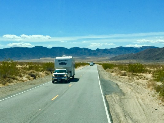
These two pictures were taken somewhere along Interstate 10 between Buckeye, AZ, and the California state line.

We use an app called AllStays Camp & RV to help us plan our routes, pick RV camps/resorts, and find places to stop for gas and snacks (mostly Flying J’s). Believe me, it is well worth the $9.99! We used the app to find a Flying J truck stop where we wanted to get gas just one mile from the California border.
Jack met a man there while putting gas in the RV, and the man asked if we were headed east or west on I 10. When Jack said we were going west, the man said it was a good thing we didn’t try to go that way the day before. The highway patrol had closed the highway from that point west into California to all eighteen wheelers and RVs because of dangerous high winds! We were SO thankful our travel day was March 15th!
Here we are crossing the border and going through the check point into California.


It was a little windy as we traveled, but it wasn’t bad. We took Interstate 10 west to a small town, Desert Center, CA, where we turned North on CA State Route 177. This highway is a little east of Joshua Tree National Park and Sheephole Valley Wilderness. Route 177 was a nice, two lane road through mostly flat desert terrain. There wasn’t much traffic on it which was a nice change from the busy Interstate 10. I’m pretty sure this photo is along Route 177 (you’ll understand why I say “I’m pretty sure” when you see more pictures).

After about 27 miles, we turned west on CA State Route 62 headed towards our destination: Twentynine Palms, CA. State Route 62 goes right through the MIDDLE of Sheephole Valley Wilderness. And, BELIEVE ME: It is a desert WILDERNESS like we’ve never seen before! Don’t get me wrong: It is beautiful in its own way. It’s just a little freaky to turn down a road and see NOTHING for miles and miles and miles (we could probably see 10-12 miles, or more, ahead because it was such a beautiful, clear day); no cars, no houses/buildings, no electric lines or poles! ABSOLUTELY NOTHING in sight. I took a few pictures and then stopped because all the pictures looked the same. We had to travel on State Route 62 about 40 miles to get to Twentynine Palms.

This is the first photo I took right after we turned on to State Route 62. There’s NOTHING out there AT ALL!! Zoom in on the picture, and you’ll see what I’m talking about.

A little farther down Route 62.

MANY miles after we got on Route 62.
I kept thinking about the early pioneers who traveled West on those covered wagons having to go through all these deserts on their way to California. Up until now it was interesting to think about and look at. State Route 62 put real meaning into the “fear” they must have felt crossing THIS desert. I felt a little fearful myself, and I was in a vehicle that could go the 40 miles in about 40-50 minutes (if it didn’t break down, that is)! The only thing that gave me comfort was that pole along the side of the road that you saw every couple of miles that said “Emergency Call Box.”
As we traveled along Route 62, I began to notice the edge of the road and the sandy shoulder. This is such flat land through the valleys and there is so much sand, that I started thinking about really windy day.s A really bad storm could create quite a sandstorm here. I wondered if, after a severe sandstorm they would have to “plow” the sand off the highway like the snowplows plow the snow off the highways in Missouri. Just wondering ………. Check out the sides of the road:


STILL….NO ONE in site!
We had been on this road for no telling HOW long. Far out in the distance we saw a speck on the road. It looked as if that speck was coming towards us! Could it be …. maybe it is ….. is it possible???? There are other humans out here?!

YIPEE!! We’re not alone! We met this RV first, and then we met several other vehicles.


We met a couple of RVs, several camping trailers, and a car traveling east! I was so excited to see some other vehicles, I just had to take some pictures!
We saw an area of the desert that was almost completely white. I have NO idea what this was or what caused it.

The white area is on the right side about a third of the way down (it looks like the white area is right above the bushes along the right side of the highway.


We finally got close to Twentynine Palms and started see houses here and there. We also noticed the road was rougher and worn in places from more frequent traffic. What a relief to reach civilization again!

You can see the road is more worn here. If you zoom in on the picture you might be able to see some houses on the right side of the road in the distance.

Again, zoom in and you can see more buildings/houses in the background. On the right side, you can see a “For Sale” sign. I wonder how much an acre of desert land costs out here?

Now you can easily see some of the town of Twentynine Palms, CA.

We are finally getting close to the RV park.
We checked in, got the camp and inside of the RV set up, and sat down at the kitchen table and looked out the window. What a gorgeous view of the San Bernardino Mountains (the highest peak is San Gorgonio Mountain).

That mountain range is about 100 miles west of Twentynine Palms!
So, for now ….. “On the Road Again!”
Betty